Algonquin Provincial Park
Algonquin Provincial Park is the oldest provincial park in Canada, having been established in 1893. It is located in Central Ontario, positioned between Georgian Bay and the Ottawa River. The park's unique location places it in a transition zone between northern coniferous forest and southern deciduous forest. This mixture of forest types supports an uncommon diversity of plant and animal species. Its immense natural beauty and proximity to major urban centres like Toronto and Ottawa have made it a premier destination for outdoor recreation. The park has also been a significant source of Canadian artistic inspiration, notably for artists like Tom Thomson and the Group of Seven.
Historical Foundation and Park Formation
The establishment of Algonquin Provincial Park was a landmark event in Canadian conservation history. In the late 19th century, the area was heavily exploited by the logging industry, which harvested vast quantities of white and red pine. Concerned about the ecological consequences of unchecked deforestation, the Ontario government appointed a Royal Commission in 1892 to investigate. The commission, chaired by Alexander Kirkwood and including members like land surveyor James Dickson and forestry expert Robert Phipps, recommended creating a public park to protect the headwaters of five major rivers. Their report, submitted in March 1893, warned of the evils of forest destruction, including dried-up streams and increased flooding. The Ontario Legislature passed the act to establish 'Algonquin National Park of Ontario' on May 23, 1893, under Premier Oliver Mowat's government. The original park covered 3,797 square kilometres across 18 townships, intended as a public park, health resort, and pleasure ground for the benefit of the people of Ontario. The park's name, changed to Algonquin Provincial Park in 1913, honours the Algonquin people, the Indigenous inhabitants of the region. The first chief ranger, Peter Thomson, was tasked with marking boundaries, removing settlers, and informing local Algonquin that traditional hunting and trapping within the new park were prohibited.
Early park management focused on controlling settlement, suppressing forest fires, and protecting wildlife, with costs offset by maintaining timber licenses. The park's boundaries were expanded several times in the years following its creation. Significant legislative updates occurred in 1910, formalizing these additions and introducing nominal fees for fishing and guide licenses. A key figure in the park's later development was Frank MacDougall, who served as chief ranger from 1931 to 1941. MacDougall pioneered the use of aircraft for park supervision, flying a Fairchild KR-34. His contributions were later honoured by naming the portion of Highway 60 that runs through the park the Frank A. MacDougall Parkway. The park's historical significance was formally recognized in 1992 when it was designated a National Historic Site for its role in developing park management practices, pioneering visitor interpretation programs, and inspiring Canadian artists.
Geography, Ecology and Climate
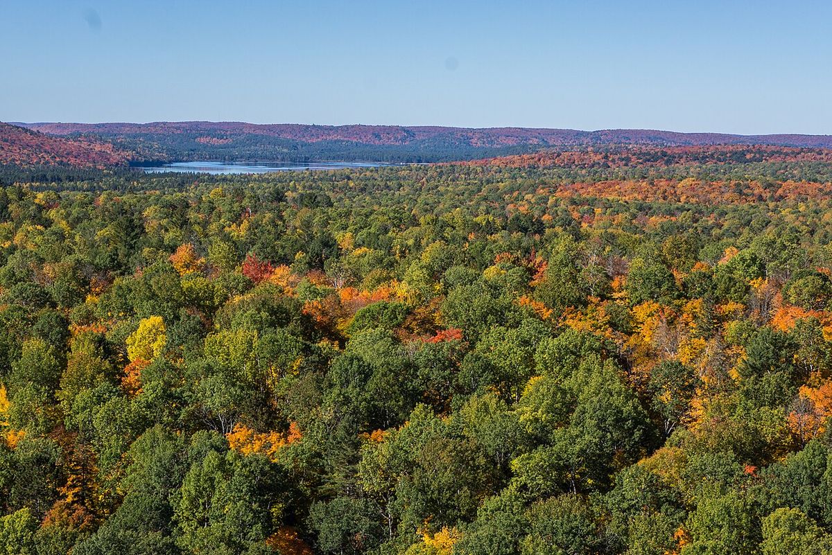
Algonquin Provincial Park occupies a massive and geologically diverse landscape shaped by the retreat of glaciers during the last ice age. This process created the park's defining features: over 2,400 lakes and 1,200 kilometres of streams and rivers. Notable waterways include Canoe Lake and the Petawawa, Nipissing, Amable du Fond, Madawaska, and Tim rivers. The park is considered part of the border between Northern and Southern Ontario, sitting in a transitional zone where the northern coniferous forest (boreal forest) meets the southern deciduous forest. This unique ecological intersection fosters a wide variety of environments, from maple hills and rocky ridges to bogs and dense woods, which in turn support an uncommon diversity of plant and animal species. The park's size and varied habitats make it an important site for ongoing wildlife research and observation.
The park experiences a humid continental climate characterized by four distinct seasons. Winters are long, cold, and snowy, with temperatures frequently dropping below -20 degrees Celsius. Summers are warm and can see temperatures exceed 30 degrees Celsius on approximately nine days per year. Precipitation averages 810 millimetres annually and is fairly evenly distributed, though late summer and early fall are typically the wettest periods, while winter months are the driest. This climate supports the mixed forest ecosystem and influences all recreational activities, from summer canoeing to winter cross-country skiing. The park's vast interior, covering 7,635 square kilometres of forests, bogs, lakes, and rivers, is primarily accessible only by paddle or on foot, preserving its wilderness character.
Forestry and Land Management
Algonquin Provincial Park holds the unique distinction within Ontario's provincial park system of permitting industrial logging within its borders. This practice is a direct legacy of the park's founding, which aimed to balance conservation with sustainable resource use. Logging is not permitted throughout the entire park but is confined to specific zones established by management plans. The foundational Algonquin Master Plan, published in 1974 after six years of public consultation, divided the park into zones with different designated uses. The most significant of these is the Recreation/Utilization zone, where forestry activities are permitted. Following amendments to the management plan in 2013, 65.3 percent of the park's land area, or 498,785 hectares, remains in this zone. Forestry operations within the park are conducted by the Algonquin Forestry Authority, a provincial agency created after the 1974 plan cancelled all private timber licenses.
Logging methods within the park include clear cutting, selection cutting, and shelterwood cutting, with only a small percentage of the park being actively logged in any given year. Operations are carried out according to a detailed Forest Management Plan prepared under the requirements of the Ontario Ministry of Natural Resources and Forestry, with opportunities for public consultation at several stages. The approved plan for 2010 to 2020, along with subsequent phase plans and annual work schedules, is publicly available. The Algonquin Forestry Authority periodically reviews applications for the expansion of existing logging roads and the construction of new ones to facilitate these operations. This continued forestry activity is carefully managed to separate logging from recreational users as much as possible, aiming to maintain the natural environment that visitors seek.
Development of Tourism and Access
The arrival of the Ottawa, Arnprior and Parry Sound Railway in 1896 transformed Algonquin Park, providing the first reliable access for visitors and industry. The railway spurred the growth of settlements like the village of Mowat on Canoe Lake, which began as a logging camp for the Gilmour Lumber Company. Park headquarters were initially established near Mowat in 1893 before relocating in 1897 to Cache Lake, adjacent to the new railway station named Algonquin Park. Under the leadership of Superintendent George W. Bartlett, appointed in 1898, a concerted effort was made to develop tourism and make the park financially self-sufficient. Bartlett encouraged short-term leases for cottages, lodges, and camps. The tourism industry blossomed with the opening of Hotel Algonquin at Joe Lake in 1908 and the Grand Trunk Railway's Highland Inn near the park headquarters soon after. Other notable establishments included Mowat Lodge, created in a former logging boarding house, and remote fishing camps like Nominigan on Smoke Lake and Camp Minnesing on Burnt Island Lake.
Rail access expanded further with the completion of the Canadian Northern Railway across the park's northern portion in 1915. Both rail lines later became part of Canadian National Railway. However, rail service gradually declined through the mid-20th century. A flood-damaged trestle on Cache Lake ended through service on the southern line in 1933, with service from the west ending in 1952 and from the east in 1959. The northern line's service ceased in 1995. Today, the primary access for most visitors is Highway 60, which runs 56 kilometres through the southern section of the park between the West Gate near Huntsville and the East Gate near Whitney. This corridor concentrates many park facilities, including campgrounds, trailheads, and museums. For the park's vast interior, access is provided by secondary highways and forest roads leading to remote campgrounds and backcountry entry points at locations like Kiosk, Brent, and Achray.
- 1896: Ottawa, Arnprior and Parry Sound Railway reaches the park, enabling tourism.
- 1908: Hotel Algonquin opens at Joe Lake, followed by the Grand Trunk Railway's Highland Inn.
- 1913: Mowat Lodge opens in the former Gilmour lumber camp boarding house.
- 1915: Canadian Northern Railway line opens across the northern park.
- 1933: Flood damage ends through rail service on the southern line.
- 1959: Rail service from the east into the park ends.
- 1995: Final rail service ends on the northern line.
Recreation and Visitor Facilities
Algonquin Provincial Park offers a vast array of year-round recreational activities, catering to both frontcountry visitors seeking convenience and backcountry adventurers pursuing wilderness solitude. Along the Highway 60 corridor, the park operates eight major campgrounds with over 1,200 individual campsites, plus additional campgrounds on the northern and eastern edges. These drive-in sites offer amenities ranging from basic tent pads to electrical hookups, with larger campgrounds featuring comfort stations with showers and laundry. Specific areas within campgrounds like Canisbay Lake, Mew Lake, Pog Lake, and Achray are designated as radio-free zones to ensure quiet. For group camping, the Whitefish Lake campground offers 18 sites accommodating groups of 20 to 40 people. The park's interior is accessed by a network of portages and trails, with hundreds of backcountry campsites available for those travelling by canoe or on foot. Three dedicated backpacking trails provide over 140 kilometres of routes with designated campsites.
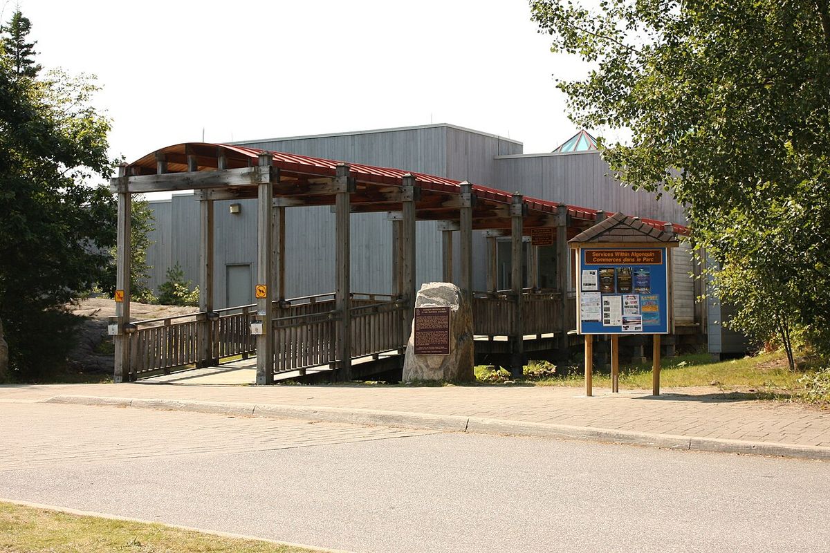
The park's educational and interpretive facilities are central to the visitor experience. The Algonquin Visitor Centre features extensive exhibits on natural and cultural history, a large relief map, a theatre, a gift shop, and the Algonquin Room art gallery. The park's Natural Heritage Education program includes a popular series of guided walks and evening programs. A highlight is the weekly public wolf howl, held on Thursday evenings in August and sometimes early September, where staff attempt to locate a pack for visitors to hear. The park also maintains 19 interpretive trails ranging from 1 to 11.7 kilometres in length, each with a guidebook explaining aspects of park ecology or history. Notable trails include the Beaver Pond Trail and the Lookout Trail. For winter visitors, activities include camping in yurts at Mew Lake, cross-country skiing on groomed trails, snowshoeing, and skating.
| Activity Type | Key Facilities & Features |
|---|---|
| Frontcountry Camping | 12 campgrounds, ~1,300 sites, some with electrical service |
| Backcountry Access | Hundreds of paddle-in & hike-in sites, 3 backpacking trails (>140 km) |
| Interpretive Trails | 19 trails (1-11.7 km), e.g., Beaver Pond Trail, Lookout Trail |
| Visitor Education | Visitor Centre, Logging Museum, Art Centre, Natural Heritage Education program |
| Winter Recreation | Yurt camping, cross-country skiing, snowshoeing, skating |
Cultural and Artistic Legacy
Algonquin Provincial Park's dramatic landscapes have strongly influenced Canadian art and culture, serving as a primary muse for the well-known Group of Seven and painter Tom Thomson. Thomson worked as a guide in the park, often based out of Mowat Lodge on Canoe Lake, where he painted many of his most famous works. His campsite behind Hayhurst Point on Canoe Lake provided inspiration for masterpieces like The Jack Pine and The West Wind. Thomson's mysterious death by drowning in Canoe Lake in 1917 cemented his legend and his connection to the park. His legacy is commemorated by a cairn and totem pole memorial on Hayhurst Point and a national historic plaque at the Canoe Lake dock. The park's ability to inspire a sense of Canadian identity was a key reason for its designation as a National Historic Site in 1992. The park continues to celebrate this artistic heritage through the Algonquin Art Centre, which hosts changing exhibitions of park-related art.
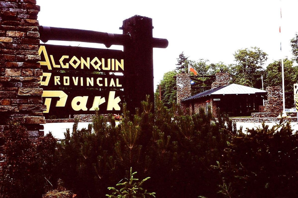
The park also preserves the history of human industry within its boundaries through the Algonquin Logging Museum, opened in 1992 near the East Gate. A 1.3-kilometre trail features a recreated logging camp and exhibits that detail the evolution of logging technology and its social history, from the early squared timber era to modern mechanical operations. This museum, along with historic structures like the park's entrance gates and former railway buildings, provides a tangible link to the past. The park's ongoing cultural relevance is supported by The Friends of Algonquin Park, a charitable organization that provides educational resources, publishes the seasonal newsletter The Raven, and manages a full calendar of public events. For many Canadians, a visit to Algonquin is more than a recreational trip. It is an engagement with a landscape that has become central to the nation's artistic and environmental consciousness.
Questions about Algonquin Provincial Park
When is the best time to visit Algonquin Provincial Park?
Algonquin Park is a true four-season destination, offering distinct experiences year-round. Summer provides warm weather ideal for canoeing, hiking, and frontcountry camping, with campgrounds like Canisbay Lake open from May into October. Fall is spectacular for viewing autumn colours. Winter activities include cross-country skiing, snowshoeing, and unique yurt camping experiences at Mew Lake. Spring brings melting ice and the reawakening of the forest. The park's extensive event calendar, including guided walks and the famous wolf howls in August, offers enrichment in every season.
How do I reserve a campsite in Algonquin Park?
Campsites in Algonquin Provincial Park must be reserved in advance through the Ontario Parks reservation system. The park has nearly 1,300 frontcountry campsites across 12 campgrounds, with opening and closing dates varying by location. For example, the Canisbay Lake campground is typically open for camping from early May to mid-October. Backcountry campsites and interior canoe routes also require permits, which can be reserved online. It is advisable to book well in advance, especially for summer weekends and the fall colour season, as sites are in high demand.
Can you go canoeing in Algonquin if you're a beginner?
Yes, Algonquin Park offers canoeing opportunities for all skill levels. Beginners can enjoy day trips on smaller, calmer lakes accessible from the Highway 60 corridor, such as Canoe Lake or Smoke Lake, often with canoe rentals available nearby. For a more guided experience, many commercial outfitters outside the park offer rental equipment, shuttle services, and trip planning advice. The park's interior, with its extensive network of lakes and portages, is better suited for those with some experience, but numerous route options allow for trips tailored to novice paddlers seeking a multi-day adventure.
Is logging still allowed in Algonquin Provincial Park?
Yes, industrial logging is permitted in designated areas of Algonquin Park, making it unique among Ontario's provincial parks. Following the park's management plan, 65.3 percent of the land area is zoned for Recreation/Utilization, where sustainable forestry is allowed. Logging is conducted by the provincial Algonquin Forestry Authority under a detailed Forest Management Plan. Operations are separated from high-use recreational areas as much as possible, and only a small percentage of the park is logged in any given year. Visitors may encounter logging trucks on some park roads, but active cut blocks are generally not near main campgrounds or trails.
What wildlife might I see in Algonquin Park?
Algonquin's diverse ecosystems support a wide range of wildlife. Commonly observed mammals include white-tailed deer, beavers, red foxes, and the park's famous moose, often seen feeding in wetlands. Black bears are present but generally avoid people. The park is renowned for its eastern wolf population, which is studied extensively and can sometimes be heard during the public wolf howls in August. Always observe wildlife from a safe distance and follow park guidelines to ensure both your safety and the animals' wellbeing.
How do I get to Algonquin Provincial Park without a car?
While having a car provides the most flexibility, it is possible to visit Algonquin Park without one. Parkbus offers scheduled bus service from Toronto to destinations along Highway 60 within the park year-round, and from Ottawa during the summer months. This service can transport visitors to key locations like the Visitor Centre or specific campgrounds. Once in the park, exploring the Highway 60 corridor can be done via bicycle or on foot along the trails, though accessing the vast interior for backcountry trips typically requires arranging shuttle services with local outfitters, which can often be coordinated in advance.
Sources and further reading
- Algonquin Provincial Park (Wikipedia)
- Algonquin Provincial Park (ontarioparks.ca)
- Algonquin Provincial Park | Ontario, Canada | The Friends of ... (algonquinpark.on.ca)
- The Ultimate Guide to Algonquin Provincial Park (northernontario.travel)
Checked by the Novello Desserts desk. Last updated 2026-10-26.