Path
The Path is an extensive network of underground pedestrian tunnels, raised walkways, and at-grade connections linking the office towers of Downtown Toronto, Ontario. Spanning over 30 kilometres, it connects more than 70 buildings and, as of 2016, contained the world's largest underground shopping complex by retail space. The system provides a climate-controlled route for over 200,000 daily users, facilitating commutes, shopping, and access to public transit and major attractions. It is a critical piece of urban infrastructure that supports the economic vitality and pedestrian mobility of Canada's largest city.
History and development
The origins of the Path network date back to 1900 with the construction of a private tunnel by the Eaton's department store. This tunnel, built underneath James Street, connected the main Eaton's store at Yonge and Queen streets to the Eaton's Annex located behind the old City Hall. This early pedestrian pathway is considered the historic precursor to the modern Path system and remains in use today, linking the Toronto Eaton Centre to the Bell Trinity Square office complex. Another significant early connection was built in 1927 to link Union Station with the Royal York Hotel, a linkage that served the network for decades before being replaced by newer infrastructure. The concept of a coordinated underground network began to take shape in the 1960s under city planner Matthew Lawson, who sought to alleviate overcrowded sidewalks and retain small businesses displaced by new office towers.
Lawson successfully convinced major developers to incorporate underground retail with the promise of future interconnections. The Toronto-Dominion Centre, completed in 1967, was the first major development to include underground shopping designed for expansion. Although city funding for such connections ended with a reform council in the 1970s, the system continued to grow organically as developers connected their buildings to meet tenant demand. This practice transformed low-value basement areas into highly profitable retail space. A key expansion in the early 1970s linked the Richmond-Adelaide Centre with the Sheraton Centre hotel complex, further solidifying the network's east-west axis. The reformers on city council disagreed with the underground system, aligning with Jane Jacobs's view that active street life was crucial for urban vitality and that shopping should occur at street level.
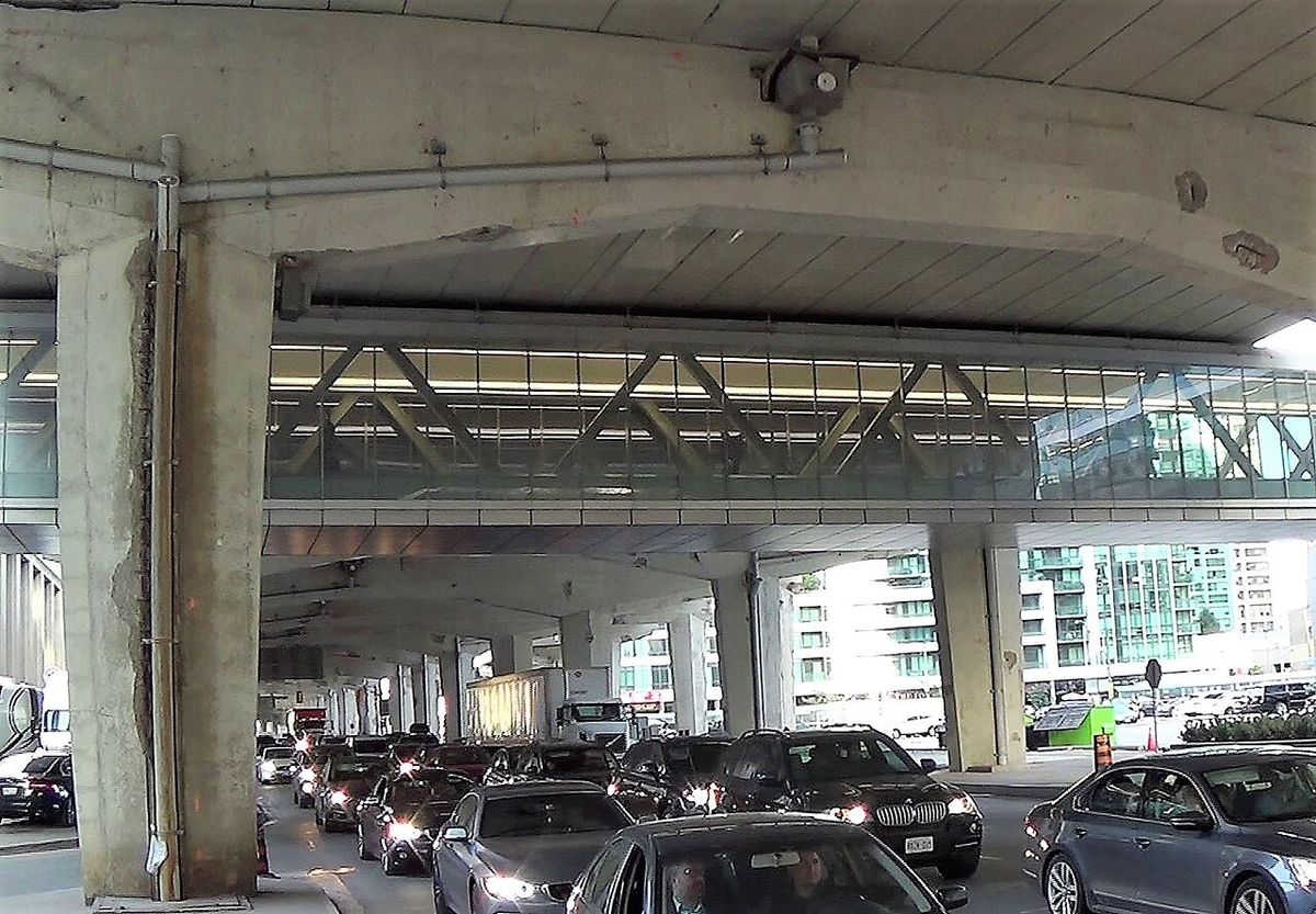
Major 21st-century developments have focused on closing gaps and extending the network's reach. Construction in 2007 closed a critical north-south gap parallel to Yonge Street by tunneling from Scotia Plaza through the Bay Adelaide Centre. A significant southward expansion occurred in August 2014 with a covered pedestrian bridge connecting Scotiabank Arena south to RBC WaterPark Place on Queens Quay, crossing the Lake Shore Boulevard and Gardiner Expressway corridor. The City of Toronto released a long-term expansion plan in 2011, developed by Urban Strategies Inc., which envisioned a network extending to 60 kilometres with 45 new entry points. Recent connections include a link opened in early November 2020 between the Maple Leaf Square complex and ÏCE Condominiums at York Centre, and the integration of the new TD Terrace at 160 Front Street West in 2024.
Design, function, and economic role
The Path serves multiple vital functions for downtown Toronto, contributing significantly to the area's economic viability and pedestrian capacity. It supplements sidewalk space, accommodating the daily flow of over 200,000 commuters alongside thousands of tourists and residents heading to cultural or sporting events. A primary benefit is its climate-controlled environment, offering a safe haven from Toronto's harsh winter cold and snow as well as relief from summer heat and humidity. The system also provides critical pedestrian linkages to public transit hubs, most notably Union Station, facilitating multimodal travel. Its extensive retail component, featuring over 1,200 storefronts across 371,600 square metres, creates a commercial corridor that generates substantial economic activity and tax revenue for the city.
The network's design is centred around several main axes that parallel key downtown streets. The primary north-south routes generally follow Yonge and Bay Streets, while the main east-west axis runs parallel to King Street. This layout creates a grid-like structure beneath the financial district. The Path connects a diverse array of facilities, creating an integrated urban environment. Key connected facilities within the network include two major department stores and two major shopping centres, twenty parking garages, and six major hotels. The system also links to the CN Tower, Ripley's Aquarium of Canada, and Rogers Centre via an enclosed walkway called the SkyWalk from Union Station, though the walkway itself does not have indoor connections into those attractions.
The COVID-19 pandemic presented a severe challenge to the Path, as lockdowns and remote work turned the active network into what Bloomberg News called a ghost town. The narrow halls in some sections were noted as a particular concern for physical distancing as employees began returning to offices. In response, the Toronto Financial District Business Improvement Area has planned various movement modifications to improve pedestrian flow and safety within the space, ensuring its continued relevance in a changed work environment. The system's value is also demonstrated by the 30,115 private dwellings located within walking distance as of 2016, highlighting its integration with downtown residential life.
Wayfinding and navigation systems
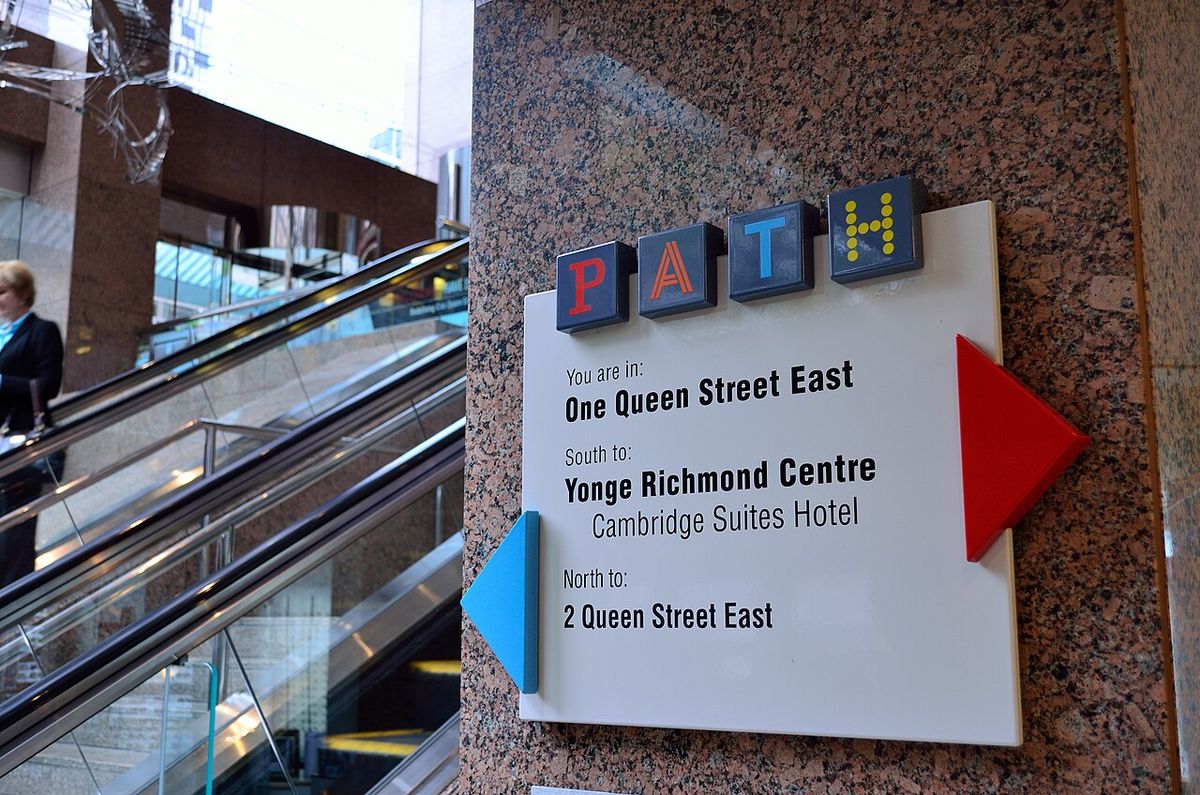
Finding a route through the sprawling Path network has been a long-standing challenge for users. The City of Toronto first adopted a unified wayfinding system in 1987, hiring design firms Gottschalk+Ash International and Muller Design Associates to create it in consultation with landowners and stakeholders. Implemented in the early 1990s, this original system used a colour-coded compass design, with ceiling signs at junctions displaying cardinal directions: red for south, orange for west, blue for north, and yellow for east. These colours were also incorporated into the Path logo itself. However, the effectiveness of this system was limited because building owners, concerned about losing foot traffic to neighbouring properties, insisted that Path signage not dominate their own interior branding. The city relented, and the result was signage that was often difficult to locate, leading to widespread complaints about the difficulty of moving through the network.
In response to these complaints, the Toronto Financial District Business Improvement Area and the City of Toronto initiated a study in 2016 to overhaul the wayfinding system. The design firm Steer Davies Gleave completed the new system in 2018, and it was rolled out in phases. A comprehensive update in 2024 brought this new system to all buildings connected to the Path. The modernized wayfinding design represents a significant shift. It has abandoned the abstract colour-coded compass points in favour of a neighbourhood- and landmark-based approach, using intuitive destination names to guide pedestrians. This updated system is integrated with TO360, Toronto's official neighbourhood mapping and wayfinding platform, allowing for coordinated digital and physical guidance.
Over the years, a number of online tools have been developed to aid movement through the complex network. These typically consist of interactive maps, suggested routes between destinations, and helpful photographs of key junctions. The combination of the updated physical signage and these digital resources has improved the experience for daily commuters and first-time visitors moving through the subterranean city. The design process for the original and updated systems involved balancing the needs of a diverse group of private building owners with the public goal of creating a coherent and usable city-wide asset.
Key connections and geographic scope
The Path network forms a dense web beneath the heart of Toronto's financial and entertainment districts. Its geographic boundaries are defined by specific terminal points and major axes. The northernmost point of the system is the Atrium on Bay at the intersection of Dundas Street and Bay Street, which once featured a tunnel to the old Toronto Coach Terminal. The southern terminus is Waterpark Place on Queens Quay, connected via the 2014 pedestrian bridge. The network's core is structured around walkways that primarily run north-south under Yonge and Bay Streets and east-west under King Street, creating an extensive grid that mirrors the street layout above. Continuous expansion, particularly around the Union Station transportation hub, remains a priority for city planners who work to guide future development.
A major recent development is the connection through the CIBC Square complex, which extends the Path eastward. This includes a pedestrian bridge crossing Yonge Street into the Backstage Condominium building at the corner of Esplanade and Yonge, providing enclosed access to Union Station, Scotiabank Arena, and other buildings in the Financial District. The City of Toronto has also constructed a dedicated 300-metre tunnel linking Union Station to Wellington Street, a $65-million project that demonstrates the commitment to integrating transit with pedestrian infrastructure. On December 5, 2020, the new Union Station Bus Terminal opened within CIBC Square and connected via a skywalk to Scotiabank Arena, adding another layer of connectivity. Planners actively work to ensure Path construction is included in the basement levels of new key buildings, guiding the network's organic growth according to the 2011 expansion plan.
The Path network connects more than 50 buildings or office towers. It comprises twenty parking garages, five subway stations, two major department stores, two major shopping centres, six major hotels, and a railway terminal. These connections convert the basement levels of downtown buildings into some of the most valuable retail space in the country. The Path provides an important contribution to the economic viability of the city's downtown core and is also used to supplement sidewalk capacity.
| Facility Type | Approximate Number Connected | Notable Examples |
|---|---|---|
| Office/Commercial Buildings | More than 50 | Toronto-Dominion Centre, Scotia Plaza, Bay Adelaide Centre |
| Subway Stations | 5 | Stations on the Yonge-University and Bloor-Danforth lines |
| Major Hotels | 6 | Sheraton Centre, Royal York Hotel |
| Major Shopping Centres | 2 | Toronto Eaton Centre, Atrium on Bay |
| Railway Terminal | 1 | Union Station |
While major attractions like the CN Tower are accessible via the enclosed SkyWalk from Union Station, the SkyWalk does not have indoor, climate-controlled connections directly into these venues. Pedestrians must exit to street level at the destination. These linkages remain a crucial part of the overall pedestrian experience, connecting the subterranean network to Toronto's major waterfront landmarks. The Path's status as the world's largest underground shopping complex was surpassed in length by Montreal's Reso network in 2023, but it remains a defining and heavily used feature of Toronto's city form.
Comparable systems and urban context
The Path exists within a North American context of similar urban pedestrian networks designed to manage climate and congestion. In Canada, comparable systems include the Plus 15 skywalk network in Calgary, Alberta, and the Edmonton Pedway in Edmonton, Alberta. The most direct domestic comparison is the RÉSO underground city in Montreal, which surpassed the Path in total length in 2023. Internationally, systems like the Chicago Pedway in the United States serve a similar function of connecting downtown buildings and transit hubs through a series of tunnels and bridges. These networks share common goals of separating pedestrians from vehicular traffic and providing weather-protected environments, though their scale, ownership models, and design philosophies differ.
Its growth in the 1960s was a direct response to overcrowded downtown sidewalks and the displacement of small businesses by new office towers. The opposition from reform city councils in the 1970s, influenced by Jane Jacobs's advocacy for active street life, highlights the ongoing tension between interior, privatized public space and traditional street-level urbanism. Despite this philosophical opposition, the system expanded because it met the practical demands of developers and tenants, converting underutilized basement space into high-value retail. This history shows the Path as a pragmatic solution that evolved despite, rather than because of, centralized city planning for much of its life.
The future of the Path is guided by the City of Toronto's 2011 expansion plan developed by Urban Strategies Inc. This plan outlines a vision for the network to grow to approximately 60 kilometres in length with the addition of 45 new entry points. This planned growth aims to improve access and connectivity, particularly in areas undergoing rapid development. The plan also involves ensuring new major buildings incorporate Path connections from their inception. The work by the Toronto Financial District Business Improvement Area to update wayfinding and modify pedestrian flow is part of ensuring the network remains functional and attractive for future users. The Path's ability to adapt post-pandemic and continue its expansion will determine its role in downtown Toronto's urban form for decades to come.
- The Eaton's tunnel, constructed in 1900 under James Street.
- The Union Station to Royal York Hotel link, built in 1927.
- The Toronto-Dominion Centre underground shopping, completed in 1967.
- The Richmond-Adelaide Centre to Sheraton Centre connection, built in the early 1970s.
- The Scotia Plaza to Bay Adelaide Centre tunnel, started in 2007.
- The pedestrian bridge to Waterpark Place, opened in August 2014.
- The Maple Leaf Square to ÏCE Condominiums link, opened in early November 2020.
- The TD Terrace connection at 160 Front St West, completed in 2024.
Notable facts and records
The Path holds several notable distinctions that quantify its scale and importance within Toronto. According to Guinness World Records, as of 2016 the Path was the largest underground shopping complex in the world based on its retail area of 371,600 square metres. This record was based on the over 1,200 individual retail fronts operating within the network at that time. The system's daily usage was also measured at over 200,000 people in 2016, a figure that includes downtown workers, residents, and tourists. The network's physical scale is demonstrated by its more than 30 kilometres of tunnels, walkways, and shopping areas connecting over 70 distinct buildings across the downtown core.
The Path's integration with the city's residential and commercial fabric is significant. As of 2016, there were 30,115 private dwellings located within walking distance of the network, indicating its role in serving a substantial residential population in addition to the office workforce. The system's connections to public transit are extensive, directly linking to five Toronto Transit Commission subway stations and the major intermodal hub of Union Station. The following list details key statistical and record-based facts about the Path network drawn from available data and reports.
- Total tunnel and walkway length: 30 kilometres (19 miles).
- Number of connected buildings: More than 70.
- Guinness World Record retail space (2016): 371,600 square metres (4,000,000 sq ft).
- Number of retail fronts (2016): Over 1,200.
- Estimated daily users (2016): Over 200,000.
- Private dwellings within walking distance (2016): 30,115.
- Number of connected subway stations: 5.
- Number of connected major hotels: 6.
While the Path lost its title as the longest underground network to Montreal's Reso in 2023, its concentration of retail space and daily pedestrian traffic remains immense. The City of Toronto's long-term plan aims to nearly double the network's length to 60 kilometres, which would involve significant future expansion. The system's 24-hour access policy, though subject to individual building hours, establishes it as a constant piece of downtown infrastructure. These figures collectively illustrate why the Path is considered a critical component of Toronto's downtown economy and daily life.
Questions about Path
What is the Path in Toronto?
The Path is a vast underground and raised pedestrian network in downtown Toronto that connects over 70 office towers, hotels, shopping centres, and transit stations. It consists of approximately 30 kilometres of tunnels and walkways, featuring extensive retail space and providing a climate-controlled route for daily commuters and visitors. It functions as an alternative to street-level sidewalks, offering protection from weather and direct access to key parts of the financial and entertainment districts. According to Guinness World Records, as of 2016 it was the world's largest underground shopping complex by retail space.
How do you find your way in the Path?
Movement within the Path is guided by a wayfinding system comprehensively updated in 2024. The current system uses neighbourhood and landmark names for directions, having replaced an older colour-coded compass system that used red for south, orange for west, blue for north, and yellow for east. Signage and maps are installed at junctions, and the system integrates with Toronto's TO360 digital mapping platform. Users can also access various online interactive maps and tools developed to help plot routes through the complex network.
What are the operating hours for the Path?
The Path network is officially open 24 hours a day, seven days a week. However, access to the system is dependent on the individual buildings it connects. Some building entrances, retail stores, and specific access points may have limited hours or be closed on weekends and holidays, which can restrict passage through certain sections of the network during those times. Pedestrians should check the hours of their specific destination building.
Is the Path connected to Union Station?
Yes, the Path has multiple direct, enclosed connections to Union Station, Toronto's primary rail and transit hub. These connections are vital for commuters, allowing movement between regional trains, subways, streetcars, and the downtown office towers. Recent expansions, like the link through CIBC Square and a dedicated $65-million, 300-metre tunnel to Wellington Street, have strengthened this integration. The new Union Station Bus Terminal in CIBC Square is also connected via a skywalk to Scotiabank Arena and the wider network.
What was the impact of COVID-19 on the Path?
The Path was severely impacted during the COVID-19 pandemic, with widespread remote work leading to a dramatic drop in foot traffic, described by Bloomberg News as turning the area into a ghost town. The narrow design of some walkways posed challenges for physical distancing as people began returning to offices. In response, the Toronto Financial District Business Improvement Area has planned various movement modifications to improve pedestrian flow and safety within the network for the future. The system's recovery is linked to the return of office workers and the adaptation of its spaces.
Where does the Path start and end?
The Path network's northern point is the Atrium on Bay at Dundas Street and Bay Street, which includes a now closed tunnel to the former Toronto Coach Terminal. Its southern point is Waterpark Place on Queens Quay. This extensive system connects more than 70 buildings via 30 kilometres of tunnels, walkways, and shopping areas. The network's main north south axes of walkways generally parallel Yonge and Bay Streets, while its main east west axis parallels King Street. The Path facilitates pedestrian movement throughout Toronto's Financial District, linking key locations like Union Station and Scotiabank Arena. Continuous expansion occurs around Union Station, with recent projects like CIBC Square extending the network eastward.
Sources: Wikipedia and current public reporting, checked by the Novello Desserts desk. Last updated 2026-10-27.