Qu'Appelle River
The Qu'Appelle River is a 430-kilometre waterway flowing east across southern Saskatchewan into Manitoba, where it joins the Assiniboine River. It serves as a vital ecological corridor and water source within the Prairie Pothole Region, supporting agriculture, communities, and recreation. The river's flow is now largely regulated and augmented by water diverted from the South Saskatchewan River via Lake Diefenbaker. Its name originates from a poignant Cree legend, and its valley is a defining feature of the region's landscape and culture.
Geography and Hydrology
The Qu'Appelle River begins at Lake Diefenbaker in southwestern Saskatchewan, a reservoir created by the Gardiner Dam. From there, it travels 430 kilometres eastward through a broad, glacially formed valley until it meets the Assiniboine River in Manitoba, just south of Lake of the Prairies near the village of St. Lazare. The river's course is characterized by a chain of significant lakes, particularly in its lower reaches. The river's natural flow has been fundamentally altered by water management infrastructure. The construction of the Qu'Appelle River Dam and Gardiner Dam upstream allows for the regulation and significant augmentation of flow, with most of the Qu'Appelle's present volume consisting of water diverted from the South Saskatchewan River. This engineered system is crucial for meeting the water demands of the region, especially during low-flow periods when Lake Diefenbaker supplies roughly 90 percent of the river's flow.
The watershed is administratively divided into upper and lower sections, with the dividing point at the Craven Dam east of the village of Craven. The Lower Qu'Appelle Watershed covers an area of 17,800 square kilometres from Craven to the Manitoba border. Major tributaries here include Loon, Jumping Deer, Pheasant, and Kaposvar Creeks, while lesser tributaries are Pearl, Indianhead, Redfox, Ekapo, Cutarm, and Scissor Creeks. The Upper Qu'Appelle Watershed, combined with the Wascana and Moose Jaw River watersheds, totals approximately 23,443 square kilometres. It is fed by rivers and creeks like Ridge Creek, Iskwao Creek, High Hill Creek, Deer Run Creek, Wascana Creek, Boggy Creek, Flying Creek, Last Mountain Creek, and the Moose Jaw River. The four sub-basins of the upper watershed are the Lanigan-Manitou, Wascana Creek, Last Mountain Lake, and Upper Qu'Appelle sub-basins, with the latter including all land up to the Qu'Appelle River Dam.
History and Cultural Significance
The Qu'Appelle Valley has been inhabited by Indigenous peoples, including the Cree, Saulteaux, Dakota, and Nakota, for the last 11,000 years. The river and valley derive their name from a Cree legend. As recounted by North West Company fur trader Daniel Harmon in 1804, people often heard a voice calling "kâ-têpwêt?" meaning "What is calling? They would respond, and the call would echo back, a phenomenon noted at Lebret. The name of the river in Cree is kâ-têpwêwi-sîpiy. This story was later popularized and romanticized in a Victorian-era version by Mohawk poet Pauline Johnson, who wove a tale of a young man hearing his dying bride's call, resulting in the name Echo Lake. European presence began with the fur trade. The North West Company established Fort Espérance on the lower river in 1787, and after its abandonment in 1819, the Hudson's Bay Company founded Fort Qu'Appelle in 1852.
The Qu'Appelle Valley is within Treaty 4 territory. It is home to the Cree, Saulteaux, Dakota, and Nakota peoples who have inhabited the area for the last 11,000 years. The Indian Act of 1876 forced Indigenous peoples to live on reserves. The reserves located within the valley include Piapot, Pasqua, Muscowpetung, Standing Buffalo, Cowessess, Kahkewistahaw, Sakimay, and Ochapowace.
- Piapot First Nation reserve lands are located in the valley.
- Pasqua First Nation reserve lands are located in the valley.
- Muscowpetung Saulteaux Nation reserve lands are located in the valley.
- Standing Buffalo Dakota Nation reserve lands are located in the valley.
- Cowessess First Nation reserve lands are located in the valley.
- Kahkewistahaw First Nation reserve lands are located in the valley.
- Sakimay First Nation reserve lands are located in the valley.
- Ochapowace Nation reserve lands are located in the valley.
The cultural heritage of the valley continues to be recognized. In 2026, the Saskatchewan Ecomuseums Initiative received the highest level of international recognition from the United Nations University. This initiative involved the File Hills Qu’Appelle Tribal Council and the Calling Lakes District Planning Commission. It was recognized as an outstanding Regional Centre of Expertise flagship project. The project bridges local knowledge and global perspectives on sustainable development.
Communities and Development
While no large cities sit directly on the river's banks, the Qu'Appelle watershed encompasses Regina, Saskatchewan's capital and second-largest city. The valley itself is dotted with small towns, villages, resort communities, and reserves. Key population centres along the valley include the town of Fort Qu'Appelle, located between Echo and Mission Lakes, with a population of 2,027 and deep historical significance as a confluence of trails and the Treaty 4 signing site. The town of Lumsden has 1,824 residents. The village of Craven, with a year-round population of 214, is famed for hosting the large Country Thunder Music Festival, formerly known as the Craven Country Jamboree, which temporarily makes it as populated as Saskatchewan's biggest cities. The village of Tantallon, with a population of 91, is known for a large statue of a whitetail deer and is located off Highway 8. The valley's lakeshores are lined with numerous resort villages and hamlets that swell with seasonal residents.
- On Buffalo Pound Lake, communities include the resort villages of North Grove, Sun Valley, and South Lake, and the hamlets of Parkview and Sand Point Beach.
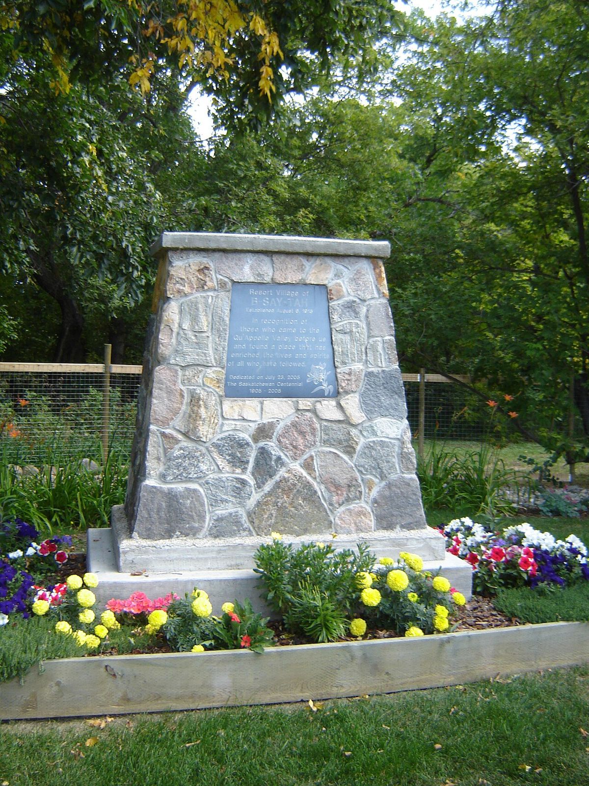
- Around the Fishing Lakes (Pasqua, Echo, Mission, Katepwa), communities include the resort villages of Fort San and B-Say-Tah, the District of Katepwa, and the organized hamlets of Pasqua Lake and Taylor Beach.
- On Crooked Lake, residential areas include Sunset Beach, Moose Bay, Exner Twins Bay, Lakeside Beach, Melville Beach, Grenfell Beach, and Greenspot.
- On Round Lake, the resort villages are Birds Point and West End.
St. Lazare is the only community on the Qu'Appelle River in Manitoba. It sits at the confluence of the Assiniboine and Qu'Appelle Rivers. This location is just south of Lake of the Prairies. The river joins the Assiniboine River at this point, which represents its terminus.
Ecology and Biodiversity
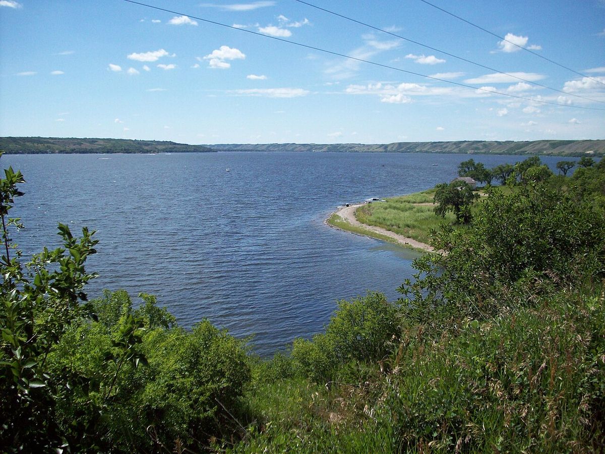
The Qu'Appelle Valley is a mosaic of three primary ecosystems: grasslands, forests, and wetlands. The temperate grasslands, dominated by grasses and herbs, are among the world's most endangered ecosystems, often converted to farmland or developed for human expansion. Grasslands have few tree types, and plants must be drought-tolerant with deep roots to connect to groundwater and reduce erosion. Forests of trembling aspen and green ash grow on valley slopes, with bur oak prevalent in the eastern sections on south-facing slopes. Wetlands play a critical role in filtering toxins and pollutants, storing rain and floodwaters to reduce flooding, and providing food and habitat for animals while feeding the groundwater supply. The Manitoba portion of the valley is considered a biodiversity hotspot supporting numerous nationally and provincially rare species. The aquatic environment supports rich biodiversity, with 30 fish species making up 45 percent of Saskatchewan's fish diversity. Species include walleye, sauger, yellow perch, northern pike, lake whitefish, cisco, mooneye, and the federally protected bigmouth buffalo, which is found only in the Qu'Appelle watershed and is at risk due to habitat loss from altered water flows and demand for agricultural, commercial, and domestic water use. Other uncommon species are the brown bullhead, channel catfish, chestnut lamprey, and Saskatchewan's only native bass, the rock bass. Terrestrial fauna includes bird species like the wood duck, eastern wood-pewee, lazuli bunting, and indigo bunting. Reptiles include painted and snapping turtles, the red belly snake, and smooth green snake. Around 30 endangered animal species are found here, including the loggerhead shrike and northern leopard frog.
The region's climate is a sub-humid continental type, with a moist-mixed grassland biome characterized by high evaporation rates, droughts, low precipitation, and high summer temperatures. It is generally dry and sunny with extreme seasonal temperatures. Mean annual precipitation is 365 millimetres. Between 1981 and 2010, the mean January temperature was -14.2 °C and the mean July temperature was 18.5 °C. The soil is primarily chernozemic, built up from centuries of grassland litter decomposition which takes three to four years to break down, and ranges from light brown to black. It is neutral to slightly alkaline with a texture from loamy sand to loam that is low to moderately sensitive to compaction, and it is sensitive to erosion, a process accelerated by agriculture, invasive species, and intense seasonal snowmelt. The valley itself is a glacial feature, formed approximately 14,000 years ago when the last ice age retreated, with alluvial deposits of silt, sand, clay, and gravel reaching up to 273 metres thick in some areas like Fort Qu'Appelle.
Water Management and Challenges
Water management in the Qu'Appelle Basin is a complex and pressing issue, governed by detailed watershed plans developed with stakeholders. In the spring of 2009, planning staff from the Water Security Agency invited stakeholders in the Lower Qu'Appelle River Watershed to participate in watershed planning, forming the Eastern and Western Lower Qu'Appelle River Watershed Advisory Committees. These committees discuss aquifer protection, lake and river water management, and governance requirements. In 2026, the Saskatchewan Water Security Agency completed and funded implementation of the Lower Qu'Appelle River Watershed Plan, the 11th such source water protection strategy in the province. The plan features 65 directives across eight goal areas, including drinking water safety, water quality and quantity, industry practices, upland water management, wastewater management, solid waste management, and plan implementation. With 93 percent of the watershed land used for agriculture and five potash mines in the basin, water demand is high and projected to increase by 126 percent from 2010 to 2060. Irrigation and potash mining are expected to account for 44.1 percent of demand by 2060. Direct human-caused water demand, which accounted for 22.6 percent of the total 599,342 million litres used in 2010, is projected to increase by 162 percent by 2060. On low-flow years, roughly 90 percent of the river's flow is supplied from Lake Diefenbaker, sourced from Rocky Mountain snowmelt. However, flows in the South Saskatchewan River have dropped by 12 percent over the past century, and with only a 2 percent increase from runoff, scarcity is a concern.
Climate change presents a dual threat of increased drought and severe flooding, with studies suggesting 31 to 46 percent of eastern Rockies glacier volume could melt by 2100. Higher temperatures and longer growing seasons will increase agricultural water demand, while industry and mining are not expected to significantly increase demand under climate change scenarios, and municipal demand will rise minimally. Water quality is another significant challenge, with eutrophication and high mineral content affecting southern Saskatchewan freshwater. Algae blooms are promoted by nutrients from crop and livestock production, runoff containing fertilizers and manure, waste from waterfront properties, and waste from upstream communities. A 2013 State of the Watershed report assessed the Wascana Watershed's overall condition as "impacted" with high intensity stressors. Short-term goals focus on public education on mitigating environmental impact, such as using phosphate-free shampoo, installing low-flush toilets, and stopping illegal drainage. A water conservation scenario suggests a 14 percent reduction in demand could be achieved through reductions in agriculture, industrial, and mining use. A feasibility study by Stantec has also explored three options for improving water flow in the Upper Qu'Appelle channel to address these systemic challenges.
Recreation, Tourism and Economic Role
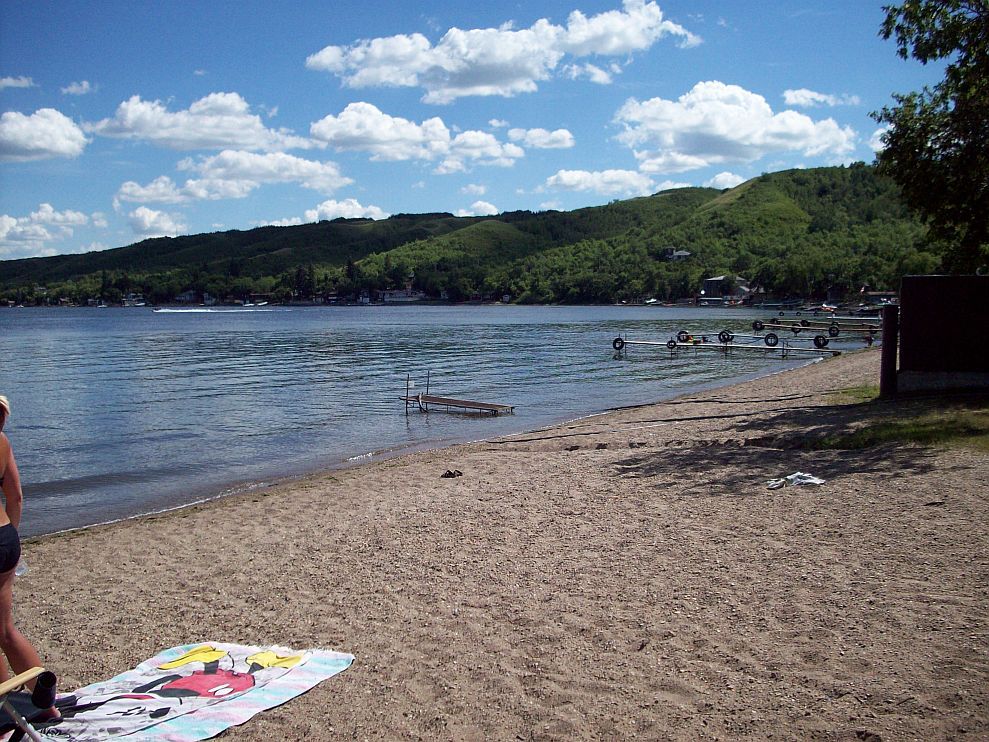
The Qu'Appelle Valley is a major recreational destination for Saskatchewan residents and visitors, prized for its scenic beauty, serene landscapes, and aquatic resources. The chain of lakes, particularly the Fishing Lakes, Crooked Lake, and Round Lake, are hubs for summer cottaging, boating, and swimming, with the water quality goals aimed at supporting recreation and fishing within ecological limits. The river and lakes are also popular for fishing, supporting species like walleye, sauger, yellow perch, northern pike, lake whitefish, cisco, common carp, and burbot. The valley's trails and parks offer opportunities for hiking, birdwatching, and nature appreciation, with the area famous for berries that grow on the moist, north-facing slopes. The town of Fort Qu'Appelle acts as a cultural and historical centre for the valley, part of the 'Valley of Dreams'. A major draw is the Country Thunder Music Festival, held near Craven, which temporarily transforms the small village into one of the province's largest population centres. The region's cultural heritage is further highlighted through initiatives like the Saskatchewan Ecomuseums Initiative which received UN recognition in 2026. The river system is central to the regional economy. Buffalo Pound Lake is part of the SaskWater-Buffalo Pound Lake regional non-potable water supply system, providing water for municipal and industrial use, including for the cities of Moose Jaw and Regina and the Mosaic Potash Mine at Belle Plaine. The river's water is essential for the agricultural sector and supports several potash mines within the basin, with an increase in irrigation development expected. The lakes and their shorelines generate substantial economic activity through tourism, property development, and related services.
| Water Demand Sector (2010 Baseline) | Estimated Demand (Million Litres) |
|---|---|
| Total Demand | 599,342 |
| Direct Human-Caused Demand | 22.6% of total |
| Agriculture (Projected 2060 share) | Majority of demand |
| Irrigation & Potash (Projected 2060 share) | 44.1% of demand |
The Lower Qu'Appelle River Watershed Plan was completed in 2026. It is backed by over $90,000 in provincial funding to the Lower Qu’Appelle Watershed Stewards. This plan represents a modern governance effort. It aims to balance multiple economic uses with long-term water security and ecological health. The Qu'Appelle River basin is considered critical to Saskatchewan's continued growth.
Questions about Qu'Appelle River
What is the origin of the name 'Qu'Appelle'?
The name comes from a Cree legend. Indigenous people told fur trader Daniel Harmon in 1804 that they often heard a spirit voice calling "kâ-têpwêt?" meaning "What is calling?" in Cree. The call would echo back when they replied. The phrase was translated into French as "Qu'appelle? (Who calls?). A later, more romanticized version of the story was popularized by poet Pauline Johnson.
What are the major lakes along the Qu'Appelle River?
The river flows through several significant lakes, particularly in its lower section known as the Fishing Lakes. From west to east, these are Pasqua Lake, Echo Lake, Mission Lake, and Katepwa Lake. Farther downstream are Crooked Lake and Round Lake. In the upper watershed, major lakes include Buffalo Pound Lake and Eyebrow Lake. Last Mountain Lake also drains into the Qu'Appelle system via Last Mountain Creek.
How is the river's water flow managed?
The river's flow is heavily regulated by dams and diversions. The Qu'Appelle River Dam at Lake Diefenbaker controls releases into the river. Most of the Qu'Appelle's present flow is not natural runoff but water diverted from the South Saskatchewan River via Lake Diefenbaker. This system ensures a reliable water supply, especially for agriculture and industry, particularly during dry periods.
What environmental challenges does the Qu'Appelle River face?
The river system faces several environmental pressures. These include high water demand for agriculture and industry, potential future water scarcity, nutrient pollution leading to algae blooms, and habitat degradation. Specific species like the bigmouth buffalo fish are at risk. Climate change threatens to increase drought and flood extremes. Shoreline development with aging septic systems also contributes to water quality issues in the lakes.
Where does the Qu'Appelle River start and end?
The Qu'Appelle River starts at Lake Diefenbaker in southwestern Saskatchewan and ends at the Assiniboine River in Manitoba. It flows eastward for 430 kilometres from its source, crossing southern Saskatchewan before entering Manitoba. Its terminus is just south of Lake of the Prairies, near the village of St. Lazare, where it joins the Assiniboine River. The river's course is significantly influenced by water management, as most of its present flow is diverted from the South Saskatchewan River via dams. This regulated flow travels through a series of lakes in the Qu'Appelle Valley before reaching its endpoint.
What is the Lower Qu'Appelle River Watershed Plan?
The Lower Qu'Appelle River Watershed Plan is a source water protection strategy completed in 2026 as part of Saskatchewan's 25 Year Water Security Plan. It is the 11th such plan in the province and contains 65 directives designed to achieve eight key goals. These goals focus on protecting drinking water sources, managing water quality and quantity, and improving practices for industry and wastewater. The plan was developed with input from stakeholders through watershed advisory committees which discuss aquifer protection and water management. Provincial government funding has been allocated to the Lower Qu’Appelle Watershed Stewards to support the implementation of this comprehensive strategy.
Sources and further reading
- Qu'Appelle River (Wikipedia)
- Qu'Appelle River (thecanadianencyclopedia.ca)
- Saskatchewan Announces Lower Qu'Appelle River ... (watercanada.net)
- Water and Environment (rmnorthquappelle.ca)
Checked by the Novello Desserts desk. Last updated 2026-10-30.