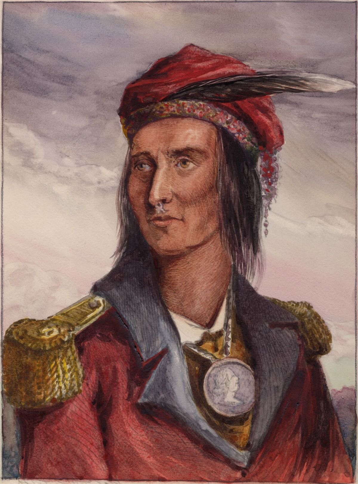
Toronto Islands
The Toronto Islands are a chain of 15 interconnected islands located in Lake Ontario, just offshore from downtown Toronto. Forming the only island group in western Lake Ontario, they provide a natural breakwater for Toronto Harbour and serve as a major public park and recreational destination. The islands are home to Toronto Island Park, the Billy Bishop Toronto City Airport, a historic residential community, and popular attractions like Centreville Amusement Park. Accessible by a short ferry ride, the car-free islands offer a unique natural escape and are a cherished part of the city's cultural and ecological landscape.
Geography and Formation
The Toronto Islands are a dynamic landform composed of alluvial sand and sediment eroded from the Scarborough Bluffs to the east. Lake Ontario's counter-clockwise current deposited this material over millennia, forming a nine-kilometre-long peninsula extending from the mainland. This peninsula was permanently severed by a violent storm on April 13, 1858, which carved a 150-metre-wide channel known as the Eastern Gap, creating the islands as they exist today. The chain is approximately five kilometres long from Ward's Island in the east to Hanlan's Point in the west, with the islands interconnected by pathways and bridges. The largest island, often called Centre Island or Toronto Island, has a crescent shape that defines the shoreline of the Eastern and Western Channels. Other significant islands include Algonquin Island, a residential area created from land reclamation, and Olympic Island, which is public parkland. Natural sediment deposition to the islands largely ceased in the 1960s following the construction of the Leslie Street Spit, but historical dredging and infilling projects have expanded the land area of several islands, including Ward's Island and the area now occupied by the airport. The area now occupied by the Billy Bishop Airport has been subject to several landfills over what was once a sandy shoal, initially to accommodate the amusement park that preceded the airport and then for the airport itself.
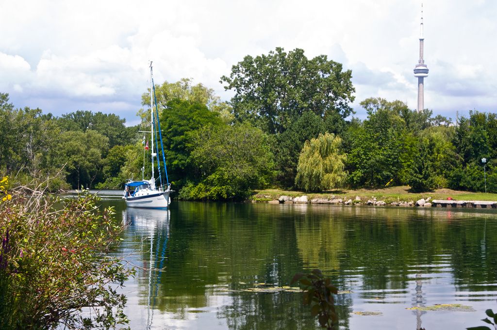
Several smaller islands fill the interior lagoons. Mugg's Island is home to the Island Yacht Club, while Forestry Island and Snake Island are heavily forested. The Royal Canadian Yacht Club occupies RCYC Island and uses North and South Chippewa Islands for ship storage and mooring. Three unnamed islands occupy the area of the former Blockhouse Bay and Long Pond, including a small ring-shaped island known as the Settling Basin, which was the former water intake for the City of Toronto. Another small island in Long Pond, sometimes called Duckling Island, is located near Middle Island. What is commonly called Ward's Island is actually the eastern end of Centre Island, and the Centre Island dock and Centreville Amusement Park are located on Middle Island, which leads to frequent confusion with Centre Island.
History and Indigenous Significance
For thousands of years prior to European colonization, the Toronto peninsula and its sandbars were a place of healing, leisure, and ceremony for Indigenous peoples, including the Mississaugas of the Credit First Nation. The area was known as Menecing, meaning "On the Island" in Ojibwe, and was also referred to as the "Island of Hiawatha." D.W. Smith's Gazetteer recorded in 1813 that the peninsula was "considered so healthy by the Indians that they resort to it whenever indisposed." British Crown records state that the islands were included in Treaty 13, the Toronto Purchase of 1787 and 1805, for which the Mississaugas received goods including 2,000 rifle flints, 24 brass kettles, 120 mirrors, 24 laced hats, and 96 gallons of rum, valued at £1,700. The Mississaugas disputed this, initiating a land claim in 1986 arguing the islands were never properly surrendered and compensation was inadequate. A settlement was reached in 2010, resulting in a payment of $145 million from the Government of Canada to the Mississaugas, who in return relinquished their claim to the islands and other lands in the area.
European activity began with a survey by Lieutenant Joseph Bouchette of the Royal Navy in 1792. The British built the first structures in the 1790s, including the Gibraltar Point Blockhouse and storage structures in 1794 to support the garrison on the mainland. By 1800, another blockhouse and guard house were added, but these were destroyed in the Battle of York in 1813. The Gibraltar Point Lighthouse was constructed in 1809 at the south-western extremity of the peninsula. Its first keeper, John Paul Radelmüller, was allegedly murdered in 1815 by soldiers from Fort York, John Henry and John Blueman of the Glengarry Light Infantry, who were charged but acquitted. The lighthouse remains one of Toronto's oldest landmarks and its keeper's demise forms the basis of one of the city's most enduring ghost stories. After the City of Toronto acquired the islands from the federal government in 1867, the land was divided into lots for seasonal cottages, amusement areas, and resort hotels, launching their development as a summer destination.
Development of the Residential Community
The evolution of the islands' residential areas reflects Toronto's changing social and administrative priorities. By the 1880s, distinct communities had formed. Along the lakefront of Centre Island, large Victorian summer homes were built by Toronto's leading families, drawn by the prestigious Royal Canadian Yacht Club which moved to RCYC Island in 1881. By contrast, the Ward's Island community began in the 1880s as a tent community. William E. Ward built Ward's Hotel and a few houses and rented tents to visitors. In 1899, there were eight summer tenants on Ward's Island paying $10 rent for the season. By 1913, the number of tents had increased to the point where the city organized the community into streets, and the tents eventually evolved into a seasonal cottage community. A one-room school operated near the Gibraltar Lighthouse from approximately 1888, becoming permanent in 1896.
In 1947, Toronto City Council approved year-round occupancy to help cope with housing shortages after the Second World War, an emergency measure meant to expire in 1968. The community peaked in the 1950s with about 630 cottages and homes, along with amenities like a movie theatre, bowling alley, stores, hotels, and dance halls. However, after the creation of Metropolitan Toronto in 1953, the new Metro Council undertook to remove the community and replace it with public parkland, partly to compensate for recreational land lost to the Gardiner Expressway. In 1955, the Metro Parks Department began demolishing homes whose leases had expired. By 1963, all residents willing to leave had departed, and the remaining residents organized to fight the plans. The Toronto Islands' Residents Association was formed in 1969. By 1970, 250 homes on Ward's and Algonquin Islands remained. Legal challenges delayed expropriation, and in 1978 Metro Council won several court battles and obtained writs of possession for the remaining homes. The situation escalated on July 28, 1980, when a sheriff sent to serve eviction notices on Algonquin Island was met by a crowd of residents and persuaded to withdraw. Provincial intervention led by mediator Barry Swadron resulted in the Toronto Islands Residential Community Stewardship Act of 1993, which granted residents continued deeds to their houses and 99-year leases on the land, administered by a Land Trust.
- 1862: Hanlan family settles at Gibraltar Point.
- 1880s: Ward's Island begins as a tent community. Victorian homes built on Centre Island.
- 1896: A permanent one-room school is established on the islands.
- 1947: Year-round occupancy approved as a temporary post-war measure.
- 1950s: Community peaks with approximately 630 homes and various commercial amenities.
- 1955: Metropolitan Toronto begins demolishing homes for parkland.
- 1969: Toronto Islands' Residents Association (TIRA) is formed.
- July 28, 1980: Residents confront and turn back a sheriff serving eviction notices.
- 1993: Toronto Islands Residential Community Stewardship Act passes, securing the community.
Under the 1993 Act, the deed to a house may be transferred only to the current owner's child or spouse. If the house must be sold and a family member is not the buyer, the process is handled by the Toronto Islands Residential Community Trust Corporation. The house and land lease are sold at a price set by the Trust to an individual from a 500-person waiting list established by lottery, preventing sale on the open market. As of late 2018, there are 262 residential properties on Ward's Island and Algonquin Island.
Attractions and Recreational Activities
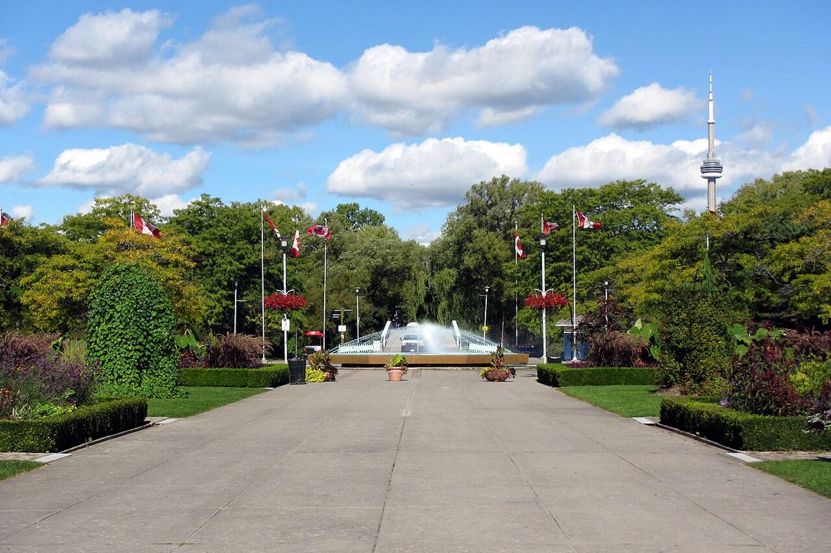
The Toronto Islands function as Toronto's premier waterfront park, offering a wide array of activities that attract millions of visitors annually. Centre Island is the central hub, featuring the popular Centreville Amusement Park, which opened in 1967. The amusement park includes over 30 rides such as a vintage carousel, a Ferris wheel, and a log flume. Adjacent to it is Far Enough Farm, a petting zoo with domestic animals that opened in 1959. The islands contain several public beaches, including the main family beach along the south shore of Centre Island. The beach on the west shore of Hanlan's Point is clothing-optional and is the historic site of Canada's first Gay Pride celebrations. Recreational rentals are a major draw from May to September, with bicycles, canoes, kayaks, paddle boats, and stand-up paddleboards available for rent at Centre Island and Ward's Island. Since 2025, Bike Share Toronto stations have also been installed on the islands.
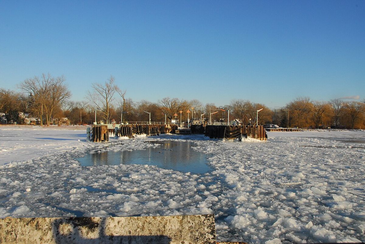
Extensive parkland provides ample space for picnics and sports, complemented by playgrounds, water play areas, and formal gardens like the Centennial Garden and the William Meany Maze. A full 18-hole disc golf course offers another active pursuit. The Gibraltar Point Lighthouse, built in 1809, is open for tours and is one of the oldest existing landmarks in Toronto. The Royal Canadian Yacht Club, with its clubhouse on RCYC Island, is a private institution with a long history on the islands. During the winter months, when the park is quieter and most facilities are closed, the lagoons and Toronto Harbour are used for ice skating when conditions permit. The islands also host the Island Public/Natural Science School, which operates classes from Junior Kindergarten to grade 6 and runs a residential natural science program for visiting grade 5 and 6 students that began in 1960.
- Centreville Amusement Park: Opened in 1967, features over 30 rides and attractions.
- Far Enough Farm: A petting zoo operating since 1959.
- Beaches: Main Centre Island Beach and clothing-optional Hanlan's Point Beach.
- Recreational Rentals: Bicycles, canoes, kayaks, paddle boats, stand-up paddleboards (May-September).
- Disc Golf: An 18-hole course located on the islands.
- Gibraltar Point Lighthouse: Historic site built in 1809, open for tours.
- Royal Canadian Yacht Club: Private club with facilities on RCYC Island, moved to islands in 1881.
- Island Public/Natural Science School: Offers JK-Grade 6 classes and a residential program for visiting students.
Transportation and Access
Access to the Toronto Islands is exclusively by water or air, preserving their car-free environment. The primary public access is via the City of Toronto ferry service, which operates year-round from the Jack Layton Ferry Terminal at the foot of Bay Street and Queen's Quay. The ferry ride to the islands takes approximately 13 minutes. Three main ferry routes serve different island docks: Hanlan's Point, Centre Island, and Ward's Island. From May to September, privately operated water taxis also provide service from various points along the waterfront. The ferry accommodates passengers' bicycles at no extra charge, and visitors can also rent bicycles on the islands. A separate transportation system serves the Billy Bishop Toronto City Airport, located at the western end of the islands. The airport is connected to the mainland by a pedestrian tunnel and a dedicated ferry from the foot of Bathurst Street, but it is a secure area not accessible to park visitors. Once on the islands, an interconnected network of pathways allows for easy exploration on foot, by bicycle, or on rented quadricycles. The islands' status as the largest urban car-free community in North America ensures a peaceful, pedestrian-focused experience.
Historical Amusements and the Airport
The western end of the islands has a long history of entertainment and aviation. In the 1880s, the Hanlan family built Hanlan's Point Amusement Park. In 1894, a land reclamation project by the Toronto Ferry Company created space to expand the park. In 1897, Hanlan's Point Stadium was built alongside the amusement park for the Toronto Maple Leaf baseball team. The stadium was rebuilt several times, and on September 5, 1914, Babe Ruth hit his first professional home run into Lake Ontario from this stadium. In the 1920s, the Maple Leaf team moved to a new stadium on the mainland, and in 1926 the Toronto Transit Commission purchased the ferry system and amusement park, shutting down most rides that year. From 1915 to 1916, a temporary wooden hangar was built at the beach by the Curtiss Flying School, creating a floatplane aerodrome used for World War I flight training.
In 1937, construction started on a new airport on the site of the park and stadium, leading to the demolition of both. Land reclamation also connected Hanlan's Point and the Western Sandbar by infilling Hanlan's Lagoon. The cottage community along the Western Sandbar was relocated. Residents could move their cottages further south on Hanlan's Point or resettle on the newly expanded Algonquin Island, originally a sandbar known as Sunfish Island. In 1938, streets were laid out on Algonquin to accommodate 31 cottages moved by barge from Hanlan's Point. The airport opened in 1939, formally named the Port George VI Island Airport. During the early years of the Second World War, expatriate Norwegian pilots-in-training used the airport for training, until several accidents, including one where a pilot clipped the ferry boat Sam McBride, led to the school's relocation to Muskoka. A park on the mainland called Little Norway Park commemorates this period.
The Islands Today
The Toronto Islands remain a vital part of Toronto's identity, balancing ecological preservation, historic preservation, and mass public recreation. The residential community, governed by the 1993 Stewardship Act, continues as a unique, tightly knit neighbourhood where property transfers are managed by a trust to maintain affordability and continuity. The parkland, managed by the City of Toronto, sees intense seasonal use from May through September, with facilities like the amusement park, concessions, and rental operations aligning with this period. The islands also hold significant cultural importance as a gathering place, a role they have served for Indigenous peoples for millennia and continue to serve for Torontonians and visitors seeking respite from the urban core. Ongoing stewardship addresses environmental challenges like erosion, while the islands' rich history is actively interpreted. The area includes facilities such as an EMS and fire station, a theatre, an artists' retreat, and a public grade school. The islands have ample garbage and recycling bins maintained by city staff to keep the grounds clean. The view of the Toronto skyline, particularly the CN Tower, from the islands is a major draw for photographers and visitors. The Toronto Islands are an example of successful public advocacy and thoughtful urban planning, offering a rare natural sanctuary in the heart of a major city.
Questions about Toronto Islands
How do you get to the Toronto Islands?
The primary public access is via the City of Toronto ferry service, which departs year-round from the Jack Layton Ferry Terminal located at the foot of Bay Street and Queen's Quay. The ferry ride to the islands takes approximately 13 minutes. Three routes serve Hanlan's Point, Centre Island, and Ward's Island. From May to September, privately operated water taxis also provide service. A separate ferry and a pedestrian tunnel serve the Billy Bishop Toronto City Airport on the islands, but this is a secure area not accessible to park visitors.
Are cars allowed on the Toronto Islands?
No, the Toronto Islands are a car-free environment, recognized as the largest urban car-free community in North America. Only authorized service and emergency vehicles are permitted. Visitors explore the islands on foot, by bicycle, or using rented quadricycles. The ferry service accommodates passengers' bicycles at no extra charge, and bicycles are available for rent on Centre Island and Ward's Island. Bike Share Toronto stations have been available on the islands since 2025.
What are the main attractions on the Toronto Islands?
Key attractions include Toronto Island Park, Centreville Amusement Park, and several public beaches. The main beach is along the south shore of Centre Island, and the beach at Hanlan's Point is clothing-optional. There is ample parkland suitable for picnicking, several playgrounds, water play areas, and several gardens. Visitors can rent bicycles, canoes, kayaks, paddle boats, and stand-up paddle boards from May to September, and there is a disc golf course on the island.
Can you live on the Toronto Islands?
Yes, there is a year-round residential neighbourhood on the islands. As of late 2018, there are 262 residential properties on Ward's Island and Algonquin Island. The Toronto Islands Residential Community Stewardship Act, passed in 1993, granted Islanders continued deeds to their houses and 99-year leases on the land. Property transfers are managed by the Toronto Islands Residential Community Trust Corporation, with sales typically restricted to a child or spouse or to an individual on a 500-person waiting list established by lottery.
What is the historical significance of the Toronto Islands to Indigenous peoples?
The Toronto Islands have been a site of healing, ceremony, and gathering for Indigenous peoples, including the Mississaugas of the Credit First Nation, for thousands of years. The area was known as Menecing, meaning "On the Island. The islands were part of a disputed land claim related to Treaty 13 (the Toronto Purchase of 1787/1805). In 2010, a settlement was reached where the Government of Canada paid the Mississaugas $145 million, and they relinquished their claim to the islands and other surrounding lands.
Is there an airport on the Toronto Islands?
Yes, the Billy Bishop Toronto City Airport is located at the western end of the islands. It opened in 1939 as the Port George VI Island Airport and is a regional airport serving commercial flights. It is connected to the mainland by a pedestrian tunnel and a separate ferry service from the foot of Bathurst Street. The airport occupies the site of the former Hanlan's Point Amusement Park and Stadium. It is a secure zone and is not accessible to visitors of Toronto Island Park.
Sources and further reading
- Toronto Islands (Wikipedia)
- Toronto Island information website (torontoisland.com)
- Toronto Island & Ferries (toronto.ca)
Checked by the Novello Desserts desk. Last updated 2026-10-25.