Yukon River
The Yukon River is a major watercourse of northwestern North America, flowing 3,190 kilometres from its source in British Columbia through Canada's Yukon territory and the U.S. state of Alaska to the Bering Sea at the Yukon-Kuskokwim Delta. As the longest river in Yukon and Alaska, it was a principal transportation route during the 1896 to 1903 Klondike Gold Rush, and a section from Lake Laberge to the Teslin River is a national heritage river. The river supports one of the world's longest salmon runs, which is crucial for the subsistence, cultural, and commercial needs of Indigenous and local communities along its banks. Its total drainage area is 854,700 km², with an average flow of 6,400-7,000 m³/s.
Name and Origins
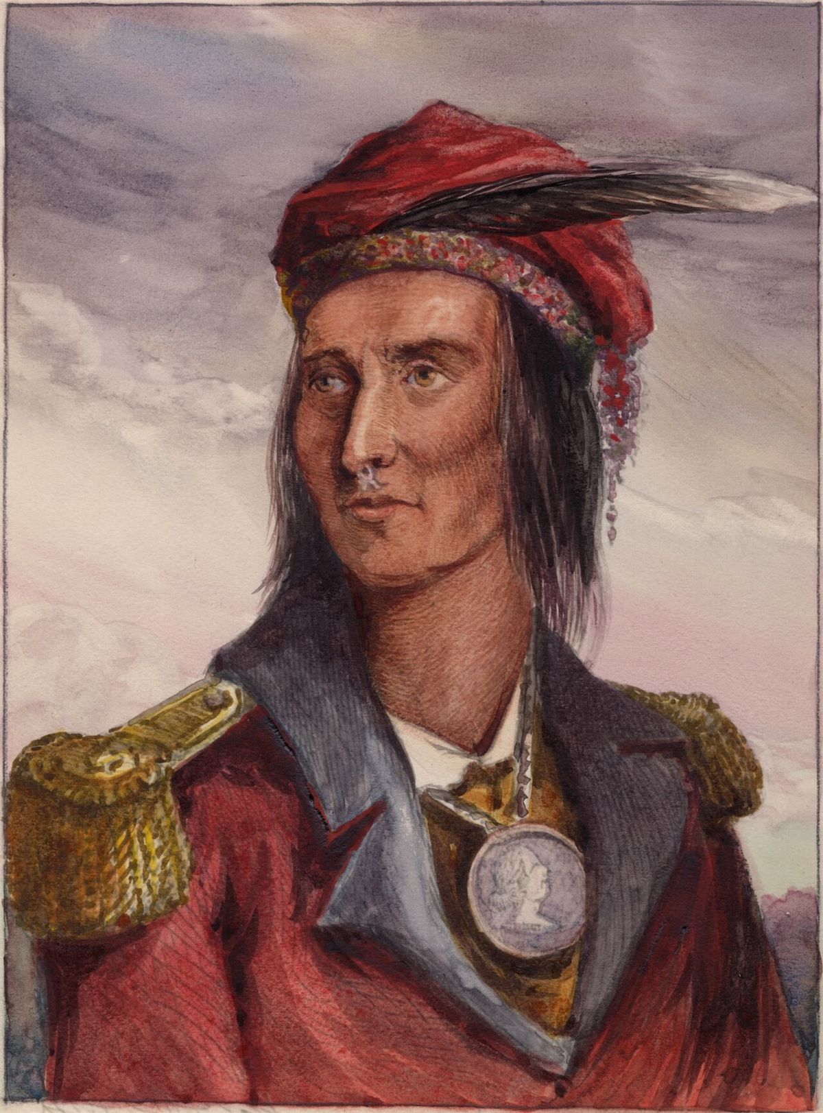
The name Yukon is derived from the Gwichʼin phrase 'chųų gąįį han', meaning 'white water river', a reference to the pale colour of glacial runoff in its waters. This contraction, recorded as Ųųg Han or Yuk Han, was documented by the Hudson's Bay Company in the 1840s after consultation with Gwich’in peoples. Earlier, Holikachuk people had told the Russian-American Company the river was called Yukkhana, meaning 'big river', but linguistic evidence suggests this was a conflation of the Gwich’in name with the Yup'ik name 'Kuig-pak', which does mean 'big river'. The upper course of the river, from Marsh Lake to the confluence with the Pelly River at Fort Selkirk, was historically known as the Lewes River before it was established as part of the main Yukon system.
Course and Geography
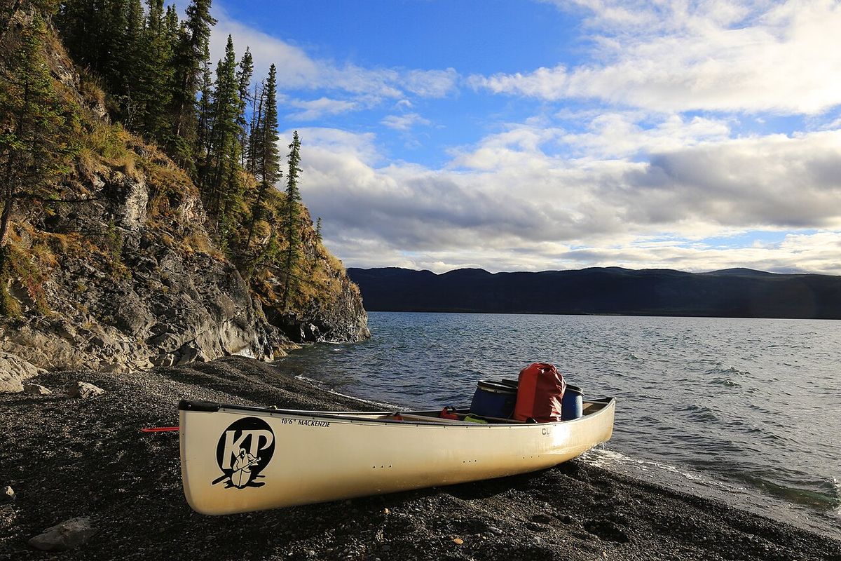
The Yukon River's exact source is debated, though the generally accepted headwaters are the Llewellyn Glacier at the southern end of Atlin Lake in British Columbia. From there, water flows through Tagish Lake and Marsh Lake, with the Yukon River proper beginning at the northern end of Marsh Lake, just south of Whitehorse. An alternative view holds that the source is Teslin Lake and the Teslin River, which delivers a larger flow when it meets the Yukon at Hootalinqua. The river flows northward from Whitehorse, widening into Lake Laberge, famously referenced in Robert W. Service's poem 'The Cremation of Sam McGee'. Other significant lakes in the system include Kusawa Lake, which feeds the Takhini River, and Kluane Lake, which drains into the Kluane and White rivers.
The Yukon River flows through many communities in Yukon and Alaska. In Yukon, it passes through Whitehorse, Carmacks, and Dawson City. In Alaska, it flows past Eagle, Circle, Fort Yukon, Stevens Village, Rampart, Tanana, Ruby, Galena, Nulato, Grayling, Holy Cross, Russian Mission, Marshall, Pilot Station, St. Marys, and Mountain Village. After Mountain Village, the river enters its vast delta region.
- Whitehorse, Yukon
- Carmacks, Yukon
- Dawson City, Yukon
- Eagle, Alaska
- Fort Yukon, Alaska
- Tanana, Alaska
- Galena, Alaska
- Russian Mission, Alaska
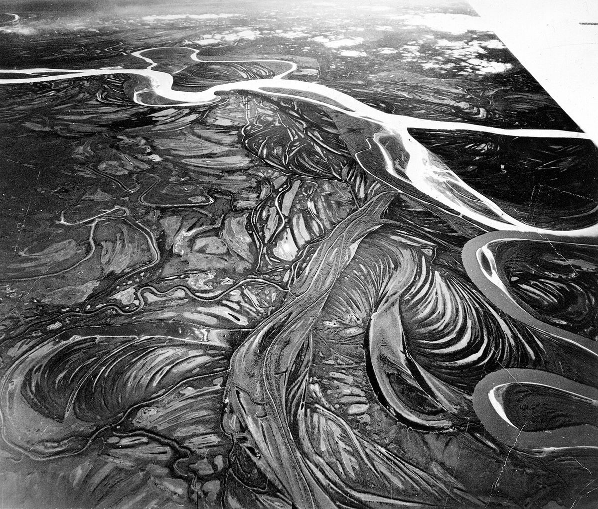
In its final stretch, the Yukon River frays into many channels across the Yukon-Kuskokwim Delta. This sprawling delta landscape is flat and covered in tundra. Communities in the delta include Nunum Iqua, Alakanuk, Emmonak, and Kotlik. Emmonak is the largest of these delta communities, with a population of roughly 760 people recorded in the 2000 census. The river ultimately empties into the Bering Sea at this delta.
Bridges and Transportation
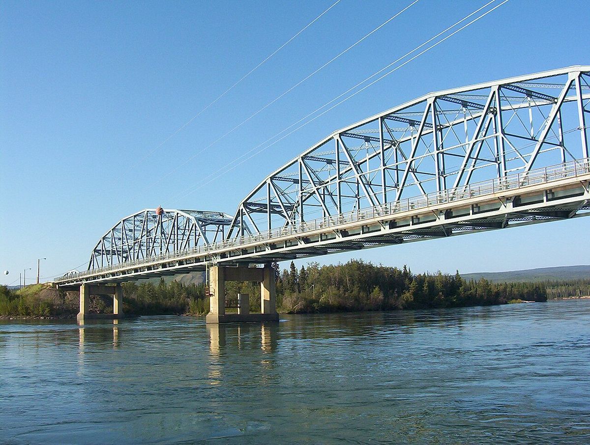
Despite its great length, only four vehicle-carrying bridges cross the Yukon River. From upstream to downstream, these are the Lewes Bridge north of Marsh Lake on the Alaska Highway, the Robert Campbell Bridge in Whitehorse, the Yukon River Bridge in Carmacks on the Klondike Highway, and the Yukon River Bridge north of Fairbanks, Alaska, on the Dalton Highway. In Dawson City, a car ferry operates in summer, replaced by an ice bridge in winter. Plans for a permanent bridge were announced in 2004 but were put on hold due to high costs. Whitehorse also features two pedestrian-only bridges and a hydroelectric dam, which created Schwatka Lake and flooded the White Horse Rapids that gave the city its name.
Summer barge service operated by companies like Ruby Marine remains a critical transportation mode for heavy goods, oil, and vehicles to communities along the Yukon, Tanana, Innoko, and Koyukuk rivers, reaching as far as Tanana on the Yukon and Nenana on the Tanana River. This service sustains remote communities where road access is limited or non-existent. The river itself presents navigational hazards, most notably the Five Finger Rapids and Rink Rapids located downstream from Carmacks, which require careful passage. Paddle-wheel riverboats were the primary mode of transport until the 1950s when highway construction reduced their role.
Ecology and Protected Areas
The Yukon River watershed encompasses diverse ecosystems, from forested slopes in the Nulato Hills, which mark the near westernmost limit of the black spruce (Picea mariana), to vast wetlands and deltas. The river flows through several significant protected areas in Alaska, which are crucial for wildlife conservation and habitat preservation. These federal refuges and preserves safeguard large tracts of the river's environment and provide opportunities for recreation and traditional use. The main protected areas along the river include:
- Innoko National Wildlife Refuge
- Nowitna National Wildlife Refuge
- Yukon-Charley Rivers National Preserve
- Yukon Delta National Wildlife Refuge
- Yukon Flats National Wildlife Refuge
Water quality in the Yukon River is generally good according to data from the U.S. Geological Survey, showing acceptable levels of turbidity, metals, and dissolved oxygen, and the Environmental Protection Agency does not list it among impaired watersheds. However, the river has a history of pollution from sources like military installations and dumps, and it carries a higher suspended sediment concentration than major Siberian Arctic rivers. The Yukon River Inter-Tribal Watershed Council, a cooperative of 70 First Nations and tribes, works to monitor and improve water quality with the goal of making the river safe to drink from again. This council supplements government data with community-based monitoring and traditional knowledge.
Salmon Fisheries and Management
The Yukon River is home to one of the world's longest salmon runs, with Chinook, coho, and chum salmon migrating thousands of kilometres from the Bering Sea to spawning grounds in Alaska, Yukon, and British Columbia. These fish are prized for their rich, fatty meat, which provides essential energy for their non-feeding migration. Communities along the river have historically relied on salmon for cultural, subsistence, and commercial purposes, preserving fish through drying, smoking, and freezing for both human and sled dog consumption. Traditional and modern fishing methods on the Yukon include set gillnets, drift nets, dip nets, and fish wheels, with gear choice depending on local river characteristics. However, salmon returns have faced severe declines over recent decades. The summer of 2023 saw only 58,500 Chinook salmon counted, the second lowest season on record. In response, fisheries managers have enacted strict measures, including the complete closure of commercial Chinook fishing in 2008 and 2009, which led to a Federal Disaster Declaration, and a 2021 ban by the Alaska Department of Fish and Game on all fishing for Chinook and chum salmon, including for subsistence. The root causes of decline are debated and may include climate change, ocean food supply issues, disease, and fishing impacts.
Multiple organizations work to protect and restore Yukon River salmon populations. The Yukon River Drainage Fisheries Association was formed in 1990 by fishers from across the drainage. Its goals include giving voice to village fishers, enabling communication with fishery managers, and preserving the ecological integrity of salmon runs and local Traditional Ecological Knowledge. Tribal organizations such as the Association of Village Council Presidents, the Council of Athabascan Tribal Governments, and the Tanana Chiefs Conference also work to sustain salmon for healthy communities.
- The Yukon River Drainage Fisheries Association (formed 1990)
- The Yukon River Panel (established 2001 under the Yukon River Salmon Agreement)
- The Association of Village Council Presidents (AVCP)
- The Council of Athabascan Tribal Governments (CATG)
- The Tanana Chiefs Conference (TCC)
Internationally, the Yukon River Salmon Agreement was passed in March 2001 by the U.S. and Canadian governments. This agreement aims to better manage the internationally shared salmon resource and ensure more Canadian-originated salmon return across the border. The agreement is implemented through the Yukon River Panel, an international body of 12 members with equal American and Canadian representation. The panel advises fishery managers on restoration, conservation, and coordinated management of Yukon River salmon.
Major Tributaries
The Yukon River is fed by a vast network of tributaries that drain a watershed larger than the province of Alberta. These tributaries vary from small creeks to major rivers, contributing to the Yukon's substantial flow and shaping its ecology. In the Yukon Territory, key tributaries include the Teslin, Pelly, Stewart, and White rivers, which join the main stem from the east and south. The Klondike River, synonymous with the gold rush, and the Fortymile River are significant northern tributaries. In Alaska, the Porcupine River, which itself drains parts of Yukon, and the Tanana River, a major Alaskan tributary, are the largest contributors. The following table lists some of the most significant tributaries and their confluence points with the main Yukon River.
| Tributary | Location of Confluence |
|---|---|
| Teslin River | Hootalinqua, Yukon |
| Pelly River | Fort Selkirk, Yukon |
| White River | Yukon/Alaska border region |
| Stewart River | Near Dawson City, Yukon |
| Klondike River | Dawson City, Yukon |
| Porcupine River | Fort Yukon, Alaska |
| Tanana River | Tanana, Alaska |
| Koyukuk River | Koyukuk, Alaska |
The Tanana River, fed by the Nabesna, Nenana, and Kantishna rivers, is particularly notable for its volume and length. The Koyukuk River, draining the Brooks Range, is another major Alaskan tributary. These waterways are not only hydrologically important but also serve as corridors for wildlife, transportation, and traditional use, integral to the entire river system's health and function. The total drainage area of the Yukon River system is 854,700 square kilometres, with the Canadian portion accounting for 323,800 square kilometres of that total.
Historical and Cultural Significance
The Yukon River's history is deeply connected with Indigenous cultures, exploration, and the Klondike Gold Rush. For millennia, the river has been a home and highway for Dene, Gwich’in, Yup'ik, and other Indigenous peoples. Paddle-wheel riverboats plied the river until the 1950s, when the completion of the Klondike Highway reduced their necessity. A section of the river in Yukon, known as 'The Thirty Mile' from Lake Laberge to the Teslin River, is designated as a national heritage river and forms part of the Klondike Gold Rush International Historical Park.
After the United States purchased Alaska in 1867, the Alaska Commercial Company acquired the assets of the Russian-American Company. The company then constructed several trading posts at various locations on the Yukon River. The river was a principal means of transportation during the 1896 to 1903 Klondike Gold Rush. A portion of the river in Yukon, known as "The Thirty Mile" section from Lake Laberge to the Teslin River, is a national heritage river and a unit of Klondike Gold Rush International Historical Park.
- Klondike Gold Rush (1896 to 1903)
- U.S. purchase of Alaska (1867)
- Operation of paddle-wheel riverboats until the 1950s
- Designation of 'The Thirty Mile' as a national heritage river
- Inclusion in Klondike Gold Rush International Historical Park
The Yukon River Inter-Tribal Watershed Council is a cooperative effort of 70 First Nations and tribes in Alaska and Canada. Its goal is to make the Yukon River and its tributaries safe to drink from again. The council works to achieve this by supplementing and scrutinizing government water-quality data. The river has a recent history of pollution from military installations, dumps, wastewater, and other sources, which the council's efforts aim to address.
Questions about Yukon River
Where is the source of the Yukon River?
The generally accepted source of the Yukon River is the Llewellyn Glacier at the southern end of Atlin Lake in British Columbia. Water flows from Atlin Lake into Tagish Lake and then Marsh Lake, where the Yukon River proper begins just south of Whitehorse. An alternative view considers the source to be Teslin Lake and the Teslin River, which delivers a larger flow when it joins the Yukon at Hootalinqua. The exact source remains a subject of some debate among geographers and hydrologists.
What is being done to protect Yukon River salmon?
Multiple organizations are working to protect Yukon River salmon. The Yukon River Salmon Agreement, passed in 2001 by the U.S. and Canadian governments, establishes coordinated international management. The Yukon River Panel advises on restoration and conservation. The Yukon River Drainage Fisheries Association represents local fishers, and tribal organizations advocate for sustainable practices. Management actions have included fishing bans, mesh size restrictions, and extensive research into causes of decline, such as climate change and bycatch.
How long is the Yukon River and where does it end?
The Yukon River is 3,190 kilometres long. It empties into the Bering Sea at the Yukon Kuskokwim Delta. The river is a major watercourse of northwestern North America, flowing from its source in British Columbia through Yukon and Alaska. Its total drainage area is 854,700 square kilometres, with over 25 percent of that area located in Canada. The river's average flow is between 6,400 and 7,000 cubic metres per second.
Why is the Yukon River important for salmon?
The Yukon River is home to one of the longest salmon runs in the world. Each year Chinook, coho, and chum salmon return to their terminal streams in Alaska, Yukon, and British Columbia. Villages along the river have historically relied on and continue to rely on salmon for their cultural, subsistence, and commercial needs. Salmon are traditionally dried, smoked, and frozen for both human and sled dog consumption. However, salmon recruitment has faced several shocks over the last 20 years, leading to fishing restrictions and closures to protect the populations.
What bridges cross the Yukon River?
There are only four vehicle carrying bridges across the Yukon River. From upstream to downstream, they are the Lewes Bridge north of Marsh Lake on the Alaska Highway, the Robert Campbell Bridge in Whitehorse, the Yukon River Bridge in Carmacks on the Klondike Highway, and the Yukon River Bridge north of Fairbanks, Alaska on the Dalton Highway. A car ferry crosses at Dawson City in summer, replaced by an ice bridge in winter. There are also two pedestrian only bridges in Whitehorse.
What is the Yukon River Inter Tribal Watershed Council?
The Yukon River Inter Tribal Watershed Council is a cooperative effort of 70 First Nations and tribes in Alaska and Canada. Its primary goal is to make the river and its tributaries safe to drink from again. The council works towards this goal by supplementing and scrutinizing government water quality data. This organization represents a significant collaborative initiative to address environmental concerns and protect the watershed shared by Indigenous communities on both sides of the border.
Sources: Wikipedia and current public reporting, checked by the Novello Desserts desk. Last updated 2026-10-21.